 NERC Data Catalogue Service
Geological mapping
Type of resources
Topics
Keywords
Contact for the resource
Provided by
Years
Formats
Representation types
Update frequencies
Scale
-

This database comprises field notebooks reporting geological field work associated with NERC Standard Grant NE/R001324/1 from 1/10/2017 – 30/6/2021. The fieldwork involved examination of Ordovician – Devonian sequences from North Wales and Scotland. Samples were collected for palynological analysis. Palynological processing involves the recovery of organic-walled microfossils by hydrochloric and hydrofluoric acid maceration. Details of other non-NERC-funded fieldwork undertaken during this period is included in the field notebooks.
-
Field notebook photos and scans for NERC grant Tellurium and Selenium Cycling and Supply. Various sites in Ireland, Scotland, England, North Wales, Norway, Utah, Colorado and Wyoming.
-

This layer of the GeoIndex shows the location of available 1:10000 scale digital geological maps within Great Britain. The Digital Geological Map of Great Britain project (DiGMapGB) has prepared 1:625 000, 1:250 000 and 1:50 000 scale datasets for England, Wales and Scotland. The datasets themselves are available as vector data in a variety of formats in which they are structured into themes primarily for use in geographical information systems (GIS) where they can be integrated with other types of spatial data for analysis and problem solving in many earth-science-related issues. The DiGMapGB-10 dataset is as yet incomplete, current work is concentrated on extending the geographical cover, especially to cover high priority urban areas.
-
This layer of the GeoIndex shows the location of available 1:25000 scale digital geological maps within Great Britain. The Digital Geological Map of Great Britain project (DiGMapGB) has prepared 1:625 000, 1:250 000 and 1:50 000 scale datasets for England, Wales and Scotland. The datasets themselves are available as vector data in a variety of formats in which they are structured into themes primarily for use in geographical information systems (GIS) where they can be integrated with other types of spatial data for analysis and problem solving in many earth-science-related issues. The DiGMapGB-10 dataset is as yet incomplete, current work is concentrated on extending the geographical cover, especially to cover high priority urban areas.
-
Scanned geophysical records, reports and track charts from Tarmac (previously Lafarge Tarmac) aggregate industry marine surveys 1989 to 2004. The geophysical records include boomer seismic and side scan sonar data of varying quality. All records from 44 boxes of paper records have been scanned at BGS and are delivered online along with any additional digital file such as reports or data files. The data are stored as part of the National Geoscience Data Centre (NGDC) and the Marine Environmental Data and Information Network (MEDIN) Data Archive Centre (DAC) for Geology and Geophysics.
-
The British Geological Survey (BGS) holds an archive of multibeam backscatter data from BGS, Maritime & Coastguard Agency (MCA) and other organisations. The data are stored within the National Geoscience Data Centre (NGDC) and the Marine Environmental Data and Information Network (MEDIN) Data Archive Centre (DAC) for Geology and Geophysics. BGS works with the partner DAC for bathymetry at the United Kingdom Hydrographic Office (UKHO) to archive backscatter data. The majority of the data were collected and processed for the Maritime and Coastguard Agency (MCA) under the Civil Hydrography Programme (CHP). Backscatter data is useful for seabed characterisation for geological and habitat mapping. View the backscatter image layer and download backscatter data (geotiff) via the BGS Offshore GeoIndex www.bgs.ac.uk/GeoIndex/offshore.htm. The data underlying the images are available on request enquiries@bgs.ac.uk. If further backscatter processing is required, BGS can provide a quote. View and download the related bathymetry data via the UKHO INSPIRE portal https://www.gov.uk/guidance/inspire-portal-and-medin-bathymetry-data-archive-centre.
-
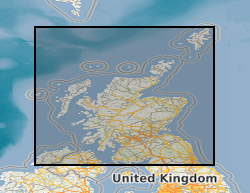
Annotated Scottish 1 inch scale maps. Printed topography with hand annotated fossil locations and geology with hand drawn cross sections, colour-wash with index and observations. Considered working material towards published geological maps.
-
Data from Marine Conservation Zone (MCZ) surveys are archived in the MEDIN Data Archive Centre (DAC) for Geology and Geophysics at the British Geological Survey. This includes geology (Particle Size Analysis) data and multibeam backscatter data. Data are delivered via the BGS Offshore GeoIndex. Additional data are available on request enquiries@bgs.ac.uk. Other data types are archived with the other MEDIN DACs as appropriate (UKHO DAC for bathymetry data and DASSH DAC for biological data). https://www.gov.uk/government/collections/marine-conservation-zone-designations-in-england.